


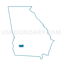
09523 - PUTNEY 1ST BAPTIST Voting District, Dougherty County, Georgia
About
Outline

Summary
| Unique Area Identifier | 561295 |
| Name | 09523 - PUTNEY 1ST BAPTIST Voting District |
| County | Dougherty County |
| State | Georgia |
| Area (square miles) | 42.70 |
| Land Area (square miles) | 42.44 |
| Water Area (square miles) | 0.26 |
| % of Land Area | 99.39 |
| % of Water Area | 0.61 |
| Latitude of the Internal Point | 31.47472010 |
| Longtitude of the Internal Point | -84.08263410 |
Maps


Graphs
Select a template below for downloading or customizing gragh for 09523 - PUTNEY 1ST BAPTIST Voting District, Dougherty County, Georgia


Neighbors
Neighoring Voting District (by Name) Neighboring Voting District on the Map
- 09522 - RADIUM MIDDLE SCHOOL Voting District, Dougherty County, GA
- 09524 - MOCK ROAD ELEM Voting District, Dougherty County, GA
- 09529 - LAMAR REESE ELEM Voting District, Dougherty County, GA
- 205BA - BACONTON Voting District, Mitchell County, GA
- 205LS - LESTER Voting District, Mitchell County, GA
- 32112 - BRIDGEBORO Voting District, Worth County, GA
- 32114 - COUNTY LINE Voting District, Worth County, GA
Top 10 Neighboring County Subdivision (by Population) Neighboring County Subdivision on the Map
- West Dougherty CCD, Dougherty County, GA (61,435)
- East Dougherty CCD, Dougherty County, GA (33,130)
- Sylvester CCD, Worth County, GA (11,757)
- Baconton CCD, Mitchell County, GA (3,515)
- Bridgeboro CCD, Worth County, GA (2,553)
Top 10 Neighboring Place (by Population) Neighboring Place on the Map
Top 10 Neighboring Unified School District (by Population) Neighboring Unified School District on the Map
- Dougherty School District, GA (94,565)
- Worth County School District, GA (21,679)
- Mitchell County School District, GA (19,600)
Top 10 Neighboring State Legislative District Lower Chamber (by Population) Neighboring State Legislative District Lower Chamber on the Map
- State House District 152, GA (47,091)
- State House District 171, GA (45,696)
- State House District 151, GA (45,471)
- State House District 150, GA (45,353)
Top 10 Neighboring State Legislative District Upper Chamber (by Population) Neighboring State Legislative District Upper Chamber on the Map
Top 10 Neighboring 111th Congressional District (by Population) Neighboring 111th Congressional District on the Map
Top 10 Neighboring Census Tract (by Population) Neighboring Census Tract on the Map
- Census Tract 9505, Worth County, GA (4,939)
- Census Tract 106.02, Dougherty County, GA (3,751)
- Census Tract 901, Mitchell County, GA (3,515)
- Census Tract 110, Dougherty County, GA (2,898)
- Census Tract 9506, Worth County, GA (2,553)
- Census Tract 116, Dougherty County, GA (1,831)
- Census Tract 109, Dougherty County, GA (1,780)